Posts

The High Weald

Image
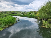
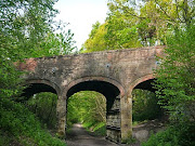
  Link to GPX File of Route   The High Weald This  is a 43 mile route through the High Weald ‘Area of Outstanding Natural Beauty’ from Crawley to the outskirts of Eastbourne, which might appeal to anyone who wants an off road trail that doesn’t involve the very rough tracks beloved of the mountain bikers.  It follows National Cycle Route 21, so mapping it involved very little effort on my part,. I have eschewed waypoints simply because I am ignorant of any compelling things to look out for on the route. The attraction is simply the generously wooded countryside; ‘Weald’ comes from the old German word ‘Wald’ and means ‘Wooded’.  But the ‘High’ in the name isn’t a misnomer and there are a few climbs between miles 21 and 31 as you head south, before a gentle cruise down from the Weald towards the coast on the ‘Cuckoo Trail’ towards Polegate Station. This is one of the many trails built on railway lines cut by Beeching in the 1960's and I believe it ran from P...

Avon & Test (Overnighter)

Image
Route GPX File :    Avon & Test Valley Route This route follows three river valleys; the Avon, Dun and Test, which dissect the rolling chalk hills of the Salisbury Plain and the Berkshire Downs. It ends at Newbury which is on the same train line as Pewsey. For the most part it follows quiet roads and scattered hamlets in open countryside. Leaving Pewsey Station, the minor road along the east side of the Avon Valley connects villages that are attractive pretty without reaching chocolate box standards. Approaching Salisbury, you pass the hillfort and castle of Old Sarum, where English Heritage recommend you ‘sniff out the old latrine pits’. Lovely. But a visit is worthwhile, if only for the views. Salisbury itself is a handsome city and worth a detour. In both cases you can see (in)famous 123m tall spire of its Cathedral. Великолепный ! The pre-historic landscape of Stonehenge is only a few miles to the east. Old Sarum The route to and along the Dun is quiet and pleasant ...

Avalon (Overnighter)

Image
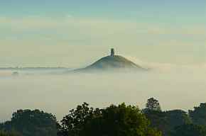
  GPX File of the Route.   Avalon This 70 mile route starts from Castle Carey, a small town in the low hills of South Somerset which, rather surprisingly, is a regular stop for trains on the main line from Paddington to the West Country. It is an easy ride, so there should be time for a bit of sightseeing. I like to do it clockwise to get the steepest hill out of the way early on. Accommodation at around the half way point on the route itself is sparse, but a short detour takes you into Burnham on Sea where there is plenty. Some five miles south of Castle Carey you pass Cadbury Castle, a candidate for King Arthur’s Camelot and a colossal hillfort. Really, it is worth climbing up it just to get an impression of the scale of the beast. It covers the equivalent of over ten football pitches. Keep in mind that the imposing ramparts were once even higher and the ditches deeper. The organisation and effort (if not the engineering) that it must have taken to build it in the Br...

Oundle (Overnighter)

Image
Nene Valley Path E of Rushden GPX File to Download      Bedford to Oundle Route This is a 73 mile circular route starting from Bedford Station. I chose to do it slowly, over two short days.  Heading out of Bedford, the fields are not far away and after you get to Rushden Green you are in rolling green countryside. The lunch stop was a great café at Higham Ferrers on the west edge of Rushden, which felt more like a village than a suburb. From there the Nene Valley Way is a gravel track through the flooded gravel pit lakes to Thrapston which you bypass on the way to Oundle. I gather that Oundle has a reputation as being bourgeois to its bootstraps with a posh school at its heart,  this one with particularly hideous uniforms for the poor girls.    Lovely honey coloured stone throughout. Nearby, the Talbot Hotel is a carefully converted historic gem, but not ‘budget’. The bar and restaurant are OK but the even older ‘Ship’, a few doors down, has great bee...

A Hillfort Near You

Image
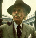
Hillforts pepper our hills, maybe around four thousand across the country. At least we  have called them hillforts. But are they? It seems that they not always on hills and probably not usually forts. The label was pinned on them by Sir Mortimer Wheeler, one of the most revered pre-history pundits of the 20th century and a former Brigadier in the Army so he might just have seen what he was programmed to see!  Sir Mortimer Wheeler Gandalf in the City?   In my own search for a sound basis for generalisation, I drew on lots of visits, slogged my way through a fat tome on hillforts generally, waded through archaeology papers in the British Library, scaled a mound of local landscape history books and tiptoed into the prehistory nerd websites. After all that, they remained inscrutable.  Some do seem to have seen conflicts. We are confident that Cadbury in Dorset saw battles with the Romans.  Others were clearly built with defence in mind, for instance by adding a...

Calleva and the Devil's Highway

Image
  GPX File of Route :   Calleva This is a tour of the Berkshire countryside which starts from Theale Station and ends up at Twyford Station, further down the line to Paddington. It links places in the valleys of the Kennet, Loddon and Blackwater rivers, starting off on the towpath of the canalised River Kennet (NCR 4) but after that follows minor roads through green, rolling mixed farming country to Aldermaston, Silchester and eastwards. The exception being a rather tedious stretch through Winnersh on the home straight.   Zoom In The standout attraction is Roman Silchester whose visible remains are, in my humble opinion, only bettered by Hadrian’s wall in the UK. There are also traces of the pre-Roman settlements here.  The bucolic Kennet towpath. The Duke of Wellington’s Estate at Stratfield Saye. (You need to pay to enter). A rather good Nature Reserve & Cafe at Dinton Pastures The odd oddity. On the debit si...